|
|
Sir Mokshagundam Visvesvaraya
Geospatial Chair
Introduction:
In the era
of information technology with rapid advancement in
computing, decision making has become more easier and
scientific and in this field, Geospatial Technology has
emerged strongly with diverse applications. It has been
identified as one of the three most important emerging
fields along with nanotechnology and biotechnology because
of providing unbiased, reliable, repetitive and synoptic
nature of data as well as tools for integration of
information for analysis, which is very useful in the
management and monitoring of natural resources. There is
requirement of trained and skilled personnel for the
maximum potential exploration of this technology and also
need to introduce it in education system for its wider
understanding. There is also a need of well thought of
plans for broader acceptability and awareness regarding
geospatial technology for development of human resource
through training and education. Geospatial Technology (GST)
encompasses Geographical Information Systems (GIS), Global
Positioning Systems (GPS), Remote Sensing (RS), and
emerging technologies that assist the user in the
collection, analysis and interpretation of spatial data.
Realising the importance of Geospatial Technology and with
a view to popularize it, the Department of Science and
Technology, Government of India, New Delhi, in honour of
and also as the year 2010 happened to be the 150th year
of birth of Sir M.Visvesvaraya has instituted Sir
Mokshagundam Visvesvaraya Geospatial Chair at Indian
Institute of Science, Bangalore. The Chair is associated
with the Department of Civil Engineering, Indian Institute
of Science, Bangalore. The Chair functions in
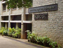
collaboration with Karnataka State Council for Science and
Technology (KSCST), IISc, Bangalore. The Chair came into
existence with Dr.A.Perumal accepting the Chair
Professorship and reporting for duty on 29th October 2012.
Objectives of the Chair:
As per the
mandate of the Chair prescribed by the Department of
Science and Technology, the Chair Professor has -
-
To carry
out the job of popularizing the Geo-spatial Technology,
for the benefit of the Students / Researchers, NGOs,
Academicians, Planners, decision makers, State / Central
Government department officials, Panchayath Raj
Institutions / Urban Local Bodies, etc.,
-
To
organise training workshops, seminars in frontier
research areas related to Geospatial Sciences, capacity
building and training programs for High School and
College students and Teachers, officials from line
departments of the State, NGOs and other user
departments who primarily use Remote Sensing, GIS and
GPS for the various developmental and implementation
programmes in the State ;
-
To promote
research on modern methods of surveying and mapping as
well as spatial data organization security, transaction
and other related issues;
-
To foster
the concept and application of geospatial technologies
in natural resources and infrastructure management.
-
To
organize multidisciplinary, multi institutional research
programmes to develop a vibrant geospatial data
infrastructure that can support decision making for
creation and management of other infrastructures.
Beneficiaries / Target users of the outputs of the Chair
:
-
Students/Researchers
-
NGOs,
Academicians, Planners and decision makers
-
State /
Central Government departments
-
Panchayath
Raj Institutions/Urban Local bodies
Activities of the Chair :
-
Organising
two days training workshop to popularize Geospatial
Technology for High School / Pre University Students and
Teachers ;
-
Organising Training Programme on Geo-spatial Technology
for the officers of KSCST who are involved in NRDMS work
in different districts of Karnataka ;
-
Organising divisional level Training Workshop for
District Officials in four divisions namely Belgaum,
Mysore, Gulbarga and Bangalore, wherein each division
covered seven to eight districts. The workshop covers
various aspects of Remote Sensing applications, GIS and
GPS which can be used for the various Water Shed and
other development programs in the grass root level ;
-
Organizing three days Workshop on Geospatial Technology
and its applications for Engineering College Faculty
wherein morning sessions includes lectures on the topics
such as Introduction to GIS and Remote Sensing, Map
making, Projection systems and Datums, Earth
Observations Systems and different Satellites, various
Satellite Products, Introduction to Photogrammetry,
Digital Image Processing, Mobile GIS concepts and
applications, Applications of GIS for Natural Resource
Management, Introduction to GPS and Total Station,
Microwave Remote Sensing and its applications and Snow
and Glacial Hydrology, and the afternoon sessions are
devoted for practicals and hands on experience.
II.
Research Projects :
-
A Study is
being carried out for Kudapura Campus of IISc,
Challakere Taluk, Chitradurga district to understand the
Morphology, sub surface Lithology, Land use, Land cover
and the Ground Water prospects of the terrain using
remote sensing and GIS ;
-
A Research
Project has been taken up to study Hesaraghatta Lake
and its catchment area using Remote Sensing and GIS
Technology to understand the reasons for drying up of
large water body using time series analysis of Remote
Sensing data ;
-
A Project
on Solid Waste Management Study in and around
Yeshwanthpur and Malleswaram area using Remote Sensing
and GIS has also been taken up.
-
In future,
other Research Projects which are socially relevant on
Natural Resources Management using Geospatial Technology
can be taken up under this Chair.
Contact
us
Karnataka State Council for Science and Technology
Indian
Institute of Science Campus, Bangalore - 560 012
Phone:
080 23341652, 2334 8848, 23348849
|


