|
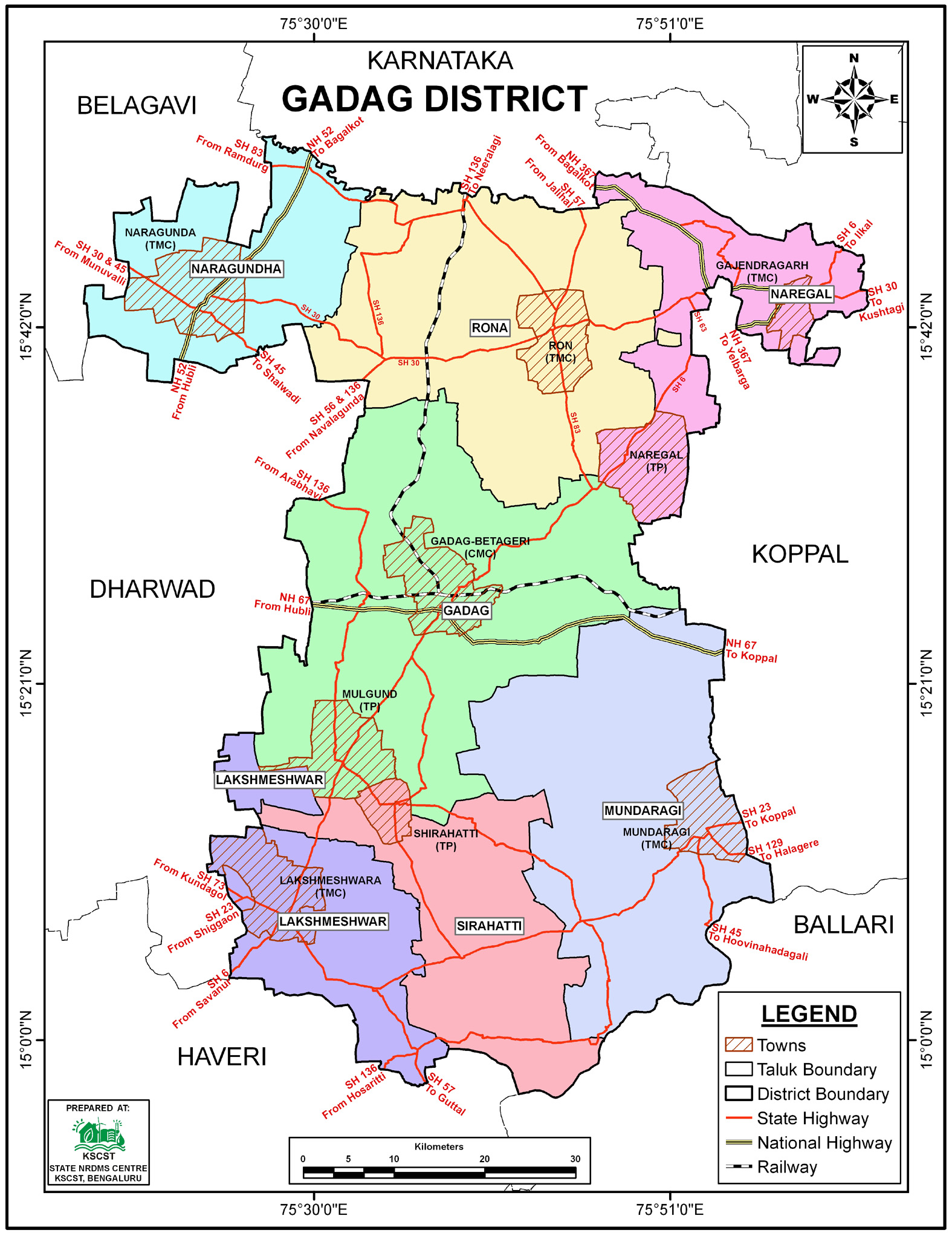
District NRDMS Center, Gadag
O/o Zilla Panchayath, Gadag District - 582101
Introduction
The
Gadag
district NRDMS Centre was established in the year
2007-2008
at Office of the
Gadag
Zilla Panchayath
with financial support from Department of Science and
Technology, Government
of India, Implemented by K.S.C.S.T, Bangalore with active
support from Department
of Science &
Technology, Government
of Karnataka. The main objective of the centre is to create
the digital database on Natural resources, Demography, Agro &
Socio economy and infrastructure facilities of the
District to provide analysed information to the district
administrators, Zilla panchayath, line departments, Academic
institutions and NGOs in Natural resources management and
rural development planning with the help of GIS and
other advanced scientific technologies.

Activities carried
out at District NRDMS Centre
-
The primary
objective of District NRDMS Centre under NRDMS Project is to
create Extensive database on Spatial Database (Maps) and Non-Spatial
Database (Attribute data) of Natural Resources, Socio & agro-economic
parameters and Infrastructure facilities of the district
after collating from the line departments and other
organizations and it is been updating regularly based on
nature of availability of data and requirements.
-
prepared a Location Map and list of villages within a 5 km
buffer of mine areas to identify those affected by mining,
providing this data to the Chief Executive Officer for the
effective implementation of the District Mines Fund (DMF).
-
Data Integration for Land Classification: Survey number-wise
data in Excel format was geo-processed by joining it with
cadastral boundary data (a standard GIS .shp
file) to delineate and generate required spatial outputs
distinguishing Wild Life Area, Non-Wild Life Area, and
Nilgiris Plantation Blocks for the Territorial Forest
Department's reference.
-
Village-level GIS mapping of HDI components (Education,
Health, Living Standard) for Gadag District was accomplished
by joining socio-economic data (Excel) to village boundary
shapefiles to produce thematic maps for reporting.
-
Generated contour maps and various other maps, along with an
Excel sheet of village-wise survey numbers, to determine the
water spread area and extent of land that would be submerged
both upstream and downstream, in support of the District
Administration's plan to increase the storage height of the
Hammagi Dam from EL 507 to 508.
-
Non-spatial crop survey data from 14 villages was integrated
with the spatial cadastral boundary data via a GIS JOIN
operation to create thematic maps for crop insurance
verification, categorizing field status
(Matched/Unmatched/Sown/Not Insured).
-
To support the proposed location of 4 new PWM Units, the
Zilla Panchayat Office, Gadag, used GIS processing to create
a 20 KM buffer around the unit locations, then clipped and
mapped the villages falling within this jurisdiction
to determine coverage.
Activity Report for the
Month April - July 2025
* ~ * ~ *
|


