|
District NRDMS Center,
Bagalkot
O/o Zilla Panchayath, Bagalkot District - 587102
Introduction
The
Bagalkot
district NRDMS Centre was established in the year
2007-2008
at Office of the
Bagalkot
Zilla Panchayath
with financial support from Department of Science and
Technology, Government
of India, Implemented by K.S.C.S.T, Bangalore with active
support from Department
of Science &
Technology, Government
of Karnataka. The main objective of the centre is to create
the digital database on Natural resources, Demography, Agro &
Socio economy and infrastructure facilities of the
District to provide analysed information to the district
administrators, Zilla panchayath, line departments, Academic
institutions and NGOs in Natural resources management and
rural development planning with the help of GIS and
other advanced scientific technologies.
Activities carried
out at District NRDMS Centre
-
The primary
objective of District NRDMS Centre under NRDMS Project is to
create Extensive database on Spatial Database (Maps) and Non-Spatial
Database (Attribute data) of Natural Resources, Socio & agro-economic
parameters and Infrastructure facilities of the district
after collating from the line departments and other
organizations and it is been updating regularly based on
nature of availability of data and requirements.
-
Technical activities focused on the specialized Avallokana
Software for data processing and reporting, and utilized Arc
GIS/GIS analysis for tasks like creating Section Boundary
Maps and analyzing spatial relationships for fire station
coverage.
-
The Centre's primary data collection effort was the SBMG
IHHL (Individual Household Latrine) report activity, which
is a highly specific, decentralized data acquisition task
requiring coordination with SBMG Nodal Officers for final
data compilation.
-
The foundational technical output revolves around developing
Geo-Spatial Action Plan Maps for key line departments
(Health, Planning, Woman & Child Development, AHVS),
demonstrating the Centre's core objective of integrating
spatial data into departmental infrastructure and social
planning.
-
The Police Accident Zone Heat Maps, This process involves
spatial statistical analysis (such as Kernel Density
Estimation) to transform point-based accident data into a
continuous, color-coded raster surface, enabling authorities
to visually identify and prioritize high-risk areas for
resource allocation.
-
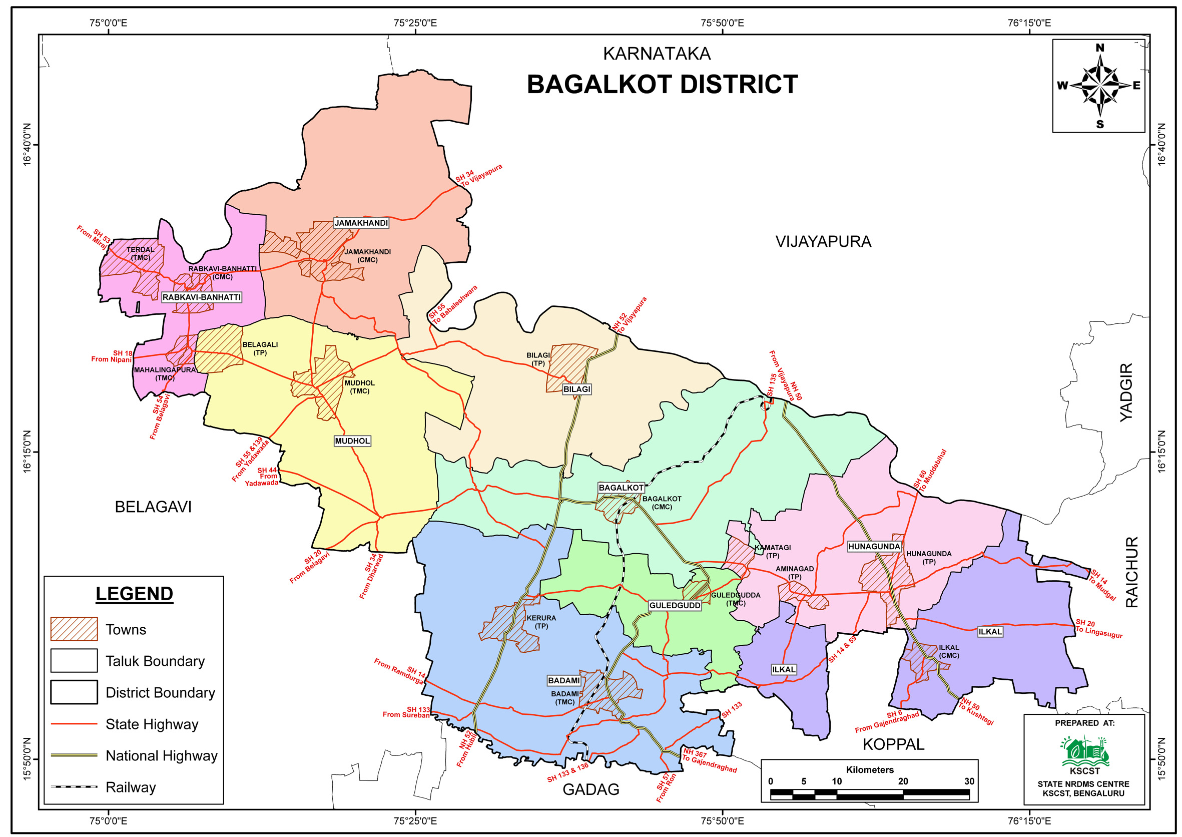
vector data layers such as Village Boundaries, Taluk
Boundaries, GP Locations, GESCOM Section Boundaries, and
Police Station Locations. This allows for complex spatial
analysis by overlaying administrative and infrastructure
data to create new thematic maps.
-
A specific map (Bagalkote Bridge cum Barrage and Check Dam
map) is used for flood monitoring in Bagalkot, integrating
data on the Almatti dam, bridge-cum-barrages, check dams,
and major rivers (Krishna, Ghataprabha, Malaprabha) to
support prevention and mitigation efforts by government
agencies (KSDMA and Water Resources Department).
Activity Report for the
Month April - July 2025
Activity Report for the Month August - November 2025
Activity Report for the Month December 2025 - March 2026
* ~ * ~ *
|