|
District NRDMS Center,
Chikkamagaluru
O/o Zilla Panchayath, Chikkamagaluru District - 577101
Introduction
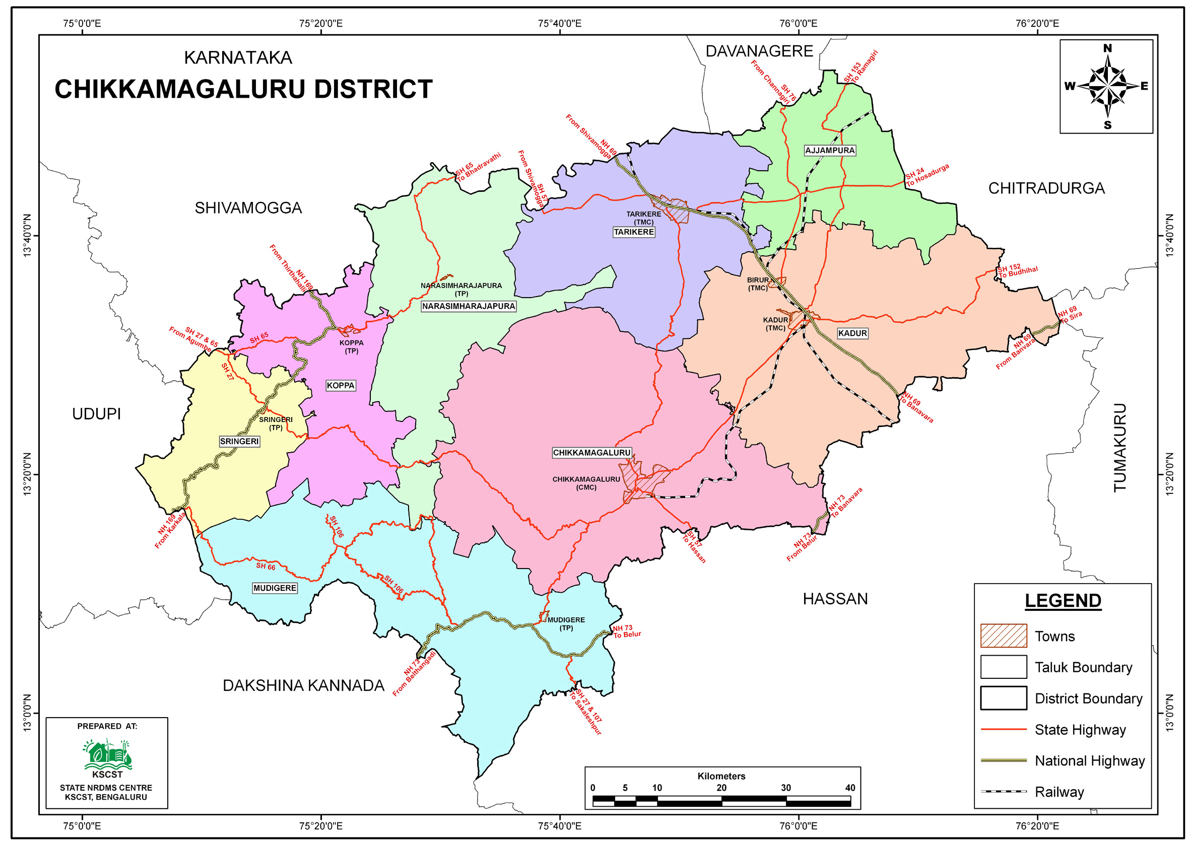
The
Chikkamagaluru
district NRDMS Centre was established in the year
2006-2007
at Office of the
Chikkamagaluru
Zilla
Panchayath with financial support from Department of Science and
Technology, Government
of India, Implemented by K.S.C.S.T, Bangalore with active
support from Department of Science &
Technology, Government
of Karnataka. The main objective of the centre is to create
the digital database on Natural resources, Demography, Agro &
Socio economy and infrastructure facilities of the
District to provide analysed information to the district
administrators, Zilla panchayath, line departments, Academic
institutions and NGOs in Natural resources management and
rural development planning with the help of GIS and
other advanced scientific technologies.
Activities carried
out at District NRDMS Centre
-
The primary
objective of District NRDMS Centre under NRDMS Project is to
create Extensive database on Spatial Database (Maps) and Non-Spatial
Database (Attribute data) of Natural Resources, Socio & agro-economic
parameters and Infrastructure facilities of the district
after collating from the line departments and other
organizations and it is been updating regularly based on
nature of availability of data and requirements.
-
Public Health Support: Provided mapping and data support to
the Health Department for managing disease control,
specifically related to TB (Tuberculosis) and
ELE-Microfilaria disease outbreaks and intervention
planning.
-
Forest Department Support: Provided mapping and data support
to the KFD (Karnataka Forest Department) for planning and
managing forest-related activities.
-
Public Education/Asset Mapping: Prepared and updated
detailed maps related to Public Education facilities and
specifically, Government School Asset Details, for data
analysis and departmental planning.
-
Technical support was provided to the Revenue Department for
developing a system that integrates historic and
experiential data with spatial data (like land records and
village boundaries) to aid the District Disaster Monitor
cell in effective disaster planning and management.
-
Technical support was given to the Zilla Panchayat to
prepare Gram/Taluk Panchayat Action Plans based on GIS for
the MGNREGA scheme, and support was also provided for NRLM
and GPCLF (Gram Panchayat Cluster Level Federation)
activities by preparing data and applications using
Microsoft PowerBI.
-
Hands-on training was provided to officials from the Social
Forestry and Forest Departments specifically on the use of
the K-GIS Web application to update information related to
the Road-Side Plantation program.
Activity Report for the
Month April - July 2025
Activity Report for the Month August - November 2025
Activity Report for the Month December 2025 - March 2026
* ~ * ~ *
|