|
District NRDMS Center, Hassan
O/o Zilla Panchayath, Hassan District - 573201
Introduction
The
Hassan
district NRDMS Centre was established in the year
1994-1995
at Office of the Hassan
Zilla Panchayath with financial support from Department of
Science and Technology, Government
of India, Implemented by K.S.C.S.T, Bangalore with active
support from Department of Science &
Technology, Government
of Karnataka. The main objective of the centre is to create
the digital database on Natural resources, Demography, Agro &
Socio economy and infrastructure facilities of the
District to provide analysed information to the district
administrators, Zilla panchayath, line departments, Academic
institutions and NGOs in Natural resources management and
rural development planning with the help of GIS and
other advanced scientific technologies.
Activities carried
out at District NRDMS Centre
-
The primary
objective of District NRDMS Centre under NRDMS Project is to
create Extensive database on Spatial Database (Maps) and Non-Spatial
Database (Attribute data) of Natural Resources, Socio & agro-economic
parameters and Infrastructure facilities of the district
after collating from the line departments and other
organizations and it is been updating regularly based on
nature of availability of data and requirements.
-
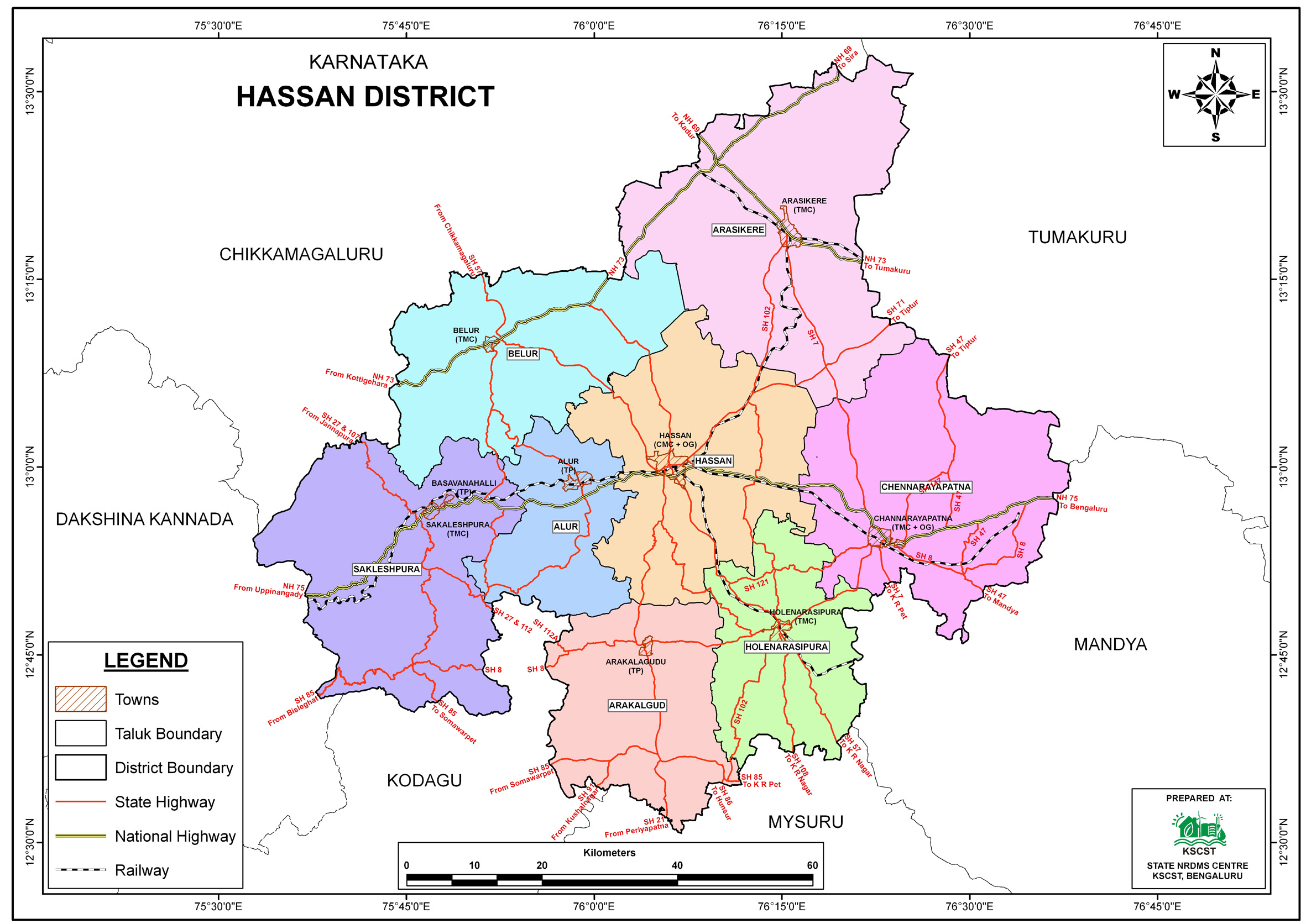
SP Office Mapping: A map containing thematic layers (roads,
boundaries, Nakabandi Data) was prepared for the
Superintendent of Police to help the police department
determine and utilize temporary office locations
-
Hoysala Stone Craft Map: A map showing the location of
Hoysala stone craft data and craftsmen in Hassan district
was prepared for the GI team, utilizing layers like roads
and railways, to help collect information and promote the
Geographical Indication (GI).
-
DC Office Mapping: Maps were prepared on the order of the
new District Collector (DC) of Hassan district in June to
review matters related to the district, utilizing a
comprehensive set of thematic layers including District,
Taluk, village, GP, and Hobli boundaries, along with all
major road networks, railways, waterbodies, and locations of
District, Taluk, Hobli, and GP Headquarters.
-
Accident Zone Mapping: A map showing the locations where
accidents happen the most in Hassan district was prepared
for the Police Department.
-
Thematic Layers: The map incorporates layers such as
District/Taluk boundary, state/national highway, District
roads, Railways, and Accident zones data.
-
The map
helps the police department identify the most accident-prone
areas and enables them to take preventive measures to avoid
accidents.
Activities and maps generated at Hassan District NRDMS Centre
Activity Report for the
Month April - July 2025
Activity Report for the
Month August - November 2025
Activity Report for the Month December 2025 - March 2026
* ~ * ~ *
|