|
District NRDMS Center,
Dakshina Kannada
O/o Zilla Panchayath, Dakshina Kannada
District, Mangaluru - 575006
Introduction
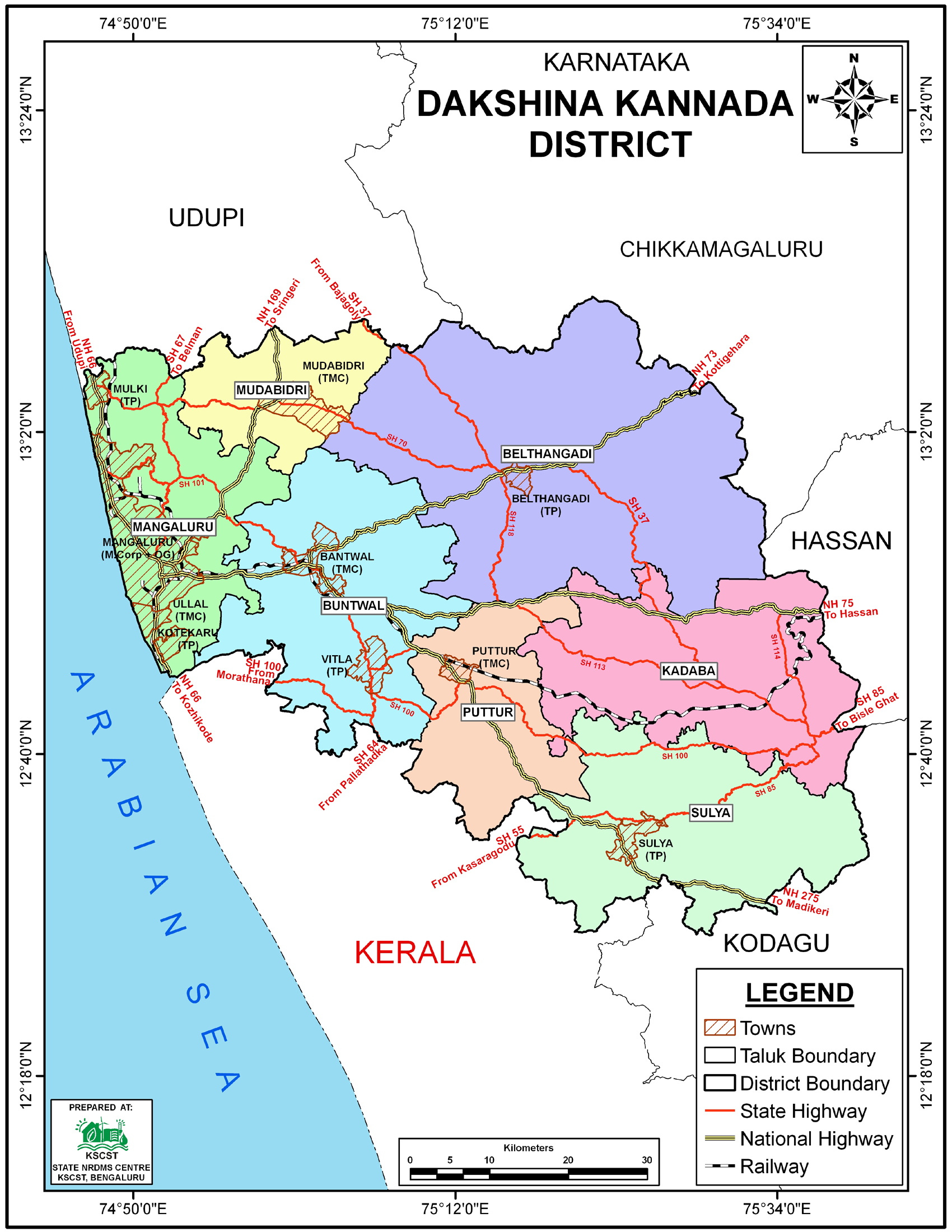
The Dakshina
Kannada district NRDMS Centre was established in the year
1992-1993
at Office of the Dakshina Kannada Zilla Panchayath with
financial support from Department of Science and Technology, Government
of India, Implemented by K.S.C.S.T, Bangalore with active
support from Department
of Science &
Technology, Government
of Karnataka. The main objective of the centre is to create
the digital database on Natural resources, Demography, Agro &
Socio economy and infrastructure facilities of the
District to provide analysed information to the district
administrators, Zilla panchayath, line departments, Academic
institutions and NGOs in Natural resources management and
rural development planning with the help of GIS and
other advanced scientific technologies.
Activities carried out at District NRDMS Centre
-
The primary
objective of District NRDMS Centre under NRDMS Project is to
create Extensive database on Spatial Database (Maps) and Non-Spatial
Database (Attribute data) of Natural Resources, Socio & agro-economic
parameters and Infrastructure facilities of the district
after collating from the line departments and other
organizations and it is been updating regularly based on
nature of availability of data and requirements.
-
Health Index
Map Preparation: Prepared a Health Index Map based on
different Health indicators, including under-5 mortality,
Maternal Mortality Ratio (MMR), and the number of mothers
who had at least four antenatal care visits. This was for
the annual NITI Aayog tool to assess and rank districts on
health performance.
-
Malaria API Map
Preparation: Prepared a category-wise, ward-wise Malaria
Annual Parasite Incidence (API) map as per the request from
the Mangalore City Corporation Health Monitoring Section.
This map categorizes cases into high, medium, and low.
-
Malaria Cases Map: Prepared a map of malaria cases for 2025
found in the Dakshina Kannada district under the Malaria
Control Program. 5-Year Dengue and
Malaria Report: Prepared a 5-year report of confirmed dengue
and malaria cases found in the district under the Malaria
Control Program.
-
Mangalore City Police Jurisdiction Maps: Prepared the
Mangalore City Police Jurisdiction map, City Cyber Crime
Map, and City Central Police Station map using ARC GIS and
QGIS software. These maps are used for planning to address
communal violence and other crimes, and they also highlight
important places and government offices.
-
SP Office Jurisdiction Maps: Created a jurisdiction map for
the Superintendent of Police (SP), detailing all police
station areas and circles, and prepared a proposal map for
new police station areas.
-
Traffic and Black Spots Map: Prepared the Mangalore City
Traffic East_West and Black Spots location map using ARC GIS
and QGIS software, with updates in progress. This map is
used for planning to address traffic violence and other
crimes, and it highlights important places and government
offices.
Activity
Report for the Month April - July 2025
Activity Report for the
Month August - November 2025
Activity Report for the Month December 2025 - March
2026
* ~ * ~ *
|